Thursday, June 11, 2009

Days 29 to 33 (June 9-13) East Bound and Down

After our great weather for camping in Amarillo, we headed South and East towards Houston and quickly returned to the hot weather that we had fled Savannah to escape. You can only delay the onset of summer for so long, I guess, and we got an extra month of enjoyable (and occasionally downright cold) days so we'll have to be content with that.

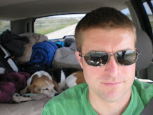
On Tuesday we made it as far as Springtown, Texas (West of Houston) where my friend Corrie lives. I haven't seen him in a while so it was good to catch up. We just ordered a pizza and sat around talking most of the night. He just finished building his garage so it was cool to check that out. On Wednesday morning we were walking around his property and heard a rustling in the bushes. I turned and saw the tall grass parting and something was coming right at me fast, then it changed direction and it became apparent that it was a fairly large reddish brown snake. It stopped right near Max but I don't think he ever saw it, so I had to get him to jump and run towards me to get him away from it. At the time we thought it might be a copperhead but upon looking at photos later I don' think it was, it didn't have the right pattern. Probably a yellow-bellied racer or something similar.


By late morning we were on the road again, heading towards Houston. We had seen Baker City, Oregon, which was a starting point of the big cattle drives down the Oregon Trail early last century, as well as North Platte Nebraska where those cattle were loaded onto trains to Houston. So of course we had to go by "Cowtown," the old Houston Stockyards, where the cattle coming down the Oregon Trail eventually arrived. We took a little walk around but the heat was building rapidly so we were back on the road, through Dallas, and East out of Texas into Louisiana.


We camped north of Shreveport Wednesday night at Cypress Black Bayou Park and set up camp, then went on a grocery run. As we walked near the lake as it was getting dark, I noticed some clouds coming in from the West. I checked the radar on the iPhone and didn't like what I saw, so as it got dark I broke down the tent and we went to sleep in the jeep. It was hot at first, but by about 10 the thunder and lightning started and I knew we didn't have long before it cooled off. A very intense lightning storm moved through for about an hour which kept Max panting and shaking. By around 11:30 it quieted down and we got some sleep.

On Thursday morning there was more rain coming through so we just grabbed a quick breakfast and hit the road. We drove downstate to Slidell, near New Orleans, where I thought we could find an affordable hotel. Camping was no longer an option in the heat. We got a hotel but the room wasn't ready yet, so we took a drive around Lake Pontchartrain and into New Orleans. I had been here before for a week in November of 2000 so I had a pretty good feel for getting around the city. It took me a while to realize that the area where I had stayed last time (Read Ave) looked so different because it had been pretty well destroyed by Hurricane Katrina in August 2005. That, of course, wasn't shocking so much as the fact that the buildings were still there, up but with windows blown out, the lower floors boarded up, roofs caved in, etc. Some buildings were little more than skeletons. Some areas had been razed and rebuilt, like the new Lowes on the corner, but almost everything else looked like the storm came through much more recent than 4 years ago. We took a quick ride through the French Quarter and stopped long enough to take a quick walk along the Mississippi River.


The heat forced us to retreat back across Lake Pontchartrain, this time across the Causeway that I had wanted to go across the last time I was here. It's about 24 miles across the water. Back to the A/C in the hotel for a few hours. We took a walk at a nearby park after dinner as the sun set but even then it was still pretty hot, around 90. So, without really being able to take any long walks, it's time to head home. We'll shoot down I-10 to my parents' house in Ponte Vedra tomorrow and visit with my old friend Brandon and his family Saturday (who are vacationing from Arizona). Then we'll head back to Savannah Saturday night.

The numbers:
33 days
25 states
11,000 miles
550 gallons of gas

It was a great trip, certainly something I'll always remember. I really think Max enjoyed most of the trip, at least until we re-entered the hot weather in the last few days. As slow as he's gotten the past few days, these are the same temperatures that we left in Savannah a month ago so we essentially got an extra month of good living. We had a lot of great hikes along the way, saw many interesting animals, and experienced an incredible diversity of landscapes as we drove our big loop around the country.

I suppose in the end I didn't learn anything new as much as put into practice something that I already knew, which was a pretty big factor in why I quit working for Nebraska Book to begin with. We've got one shot at this life. I remember this quote from Stacy Peralta a long time ago that stuck with me. He said, "Give all you've got to give now because when it's over you're going to look back, I promise." None of us will reach the end of our lives and regret not spending more time at work or making more money or buying more things. But we will all eventually lose our friends and loved ones (one way or another) and we will all run out of time to do all the things we want to do. You never know when the bad news will come. Find a way to spend time with the people (and animals) that make you happy, experience life with them, and do all the things you want to do in this world. Don't assume that you can always do those things in the future, because put it off long enough and eventually you'll be wrong.

Like I said at the beginning, I really did this blog as an easy way for me to document the trip's high points for my own memory, more like a journal than anything else. I never thought so many people would take an interest and follow along. That put a weird kind of responsibility on me to keep going, stay positive, and find new and fun things for Max and I to do. I feel that we were remarkably successful, beyond anything I could have anticipated. For that, I thank all of you reading this.

I really have no idea what lies ahead for me and Max. The future is a pretty blank canvas, which is both scary and a great opportunity. I just hope that we remember to keep this spirit of exploration and adventure alive. Whenever life gets too monotonous, shake things up and do something exciting. Use your vacation and sick days. And if you need a loyal companion to share the adventure of life with, a good dog is hard to beat.


Tuesday, June 9, 2009

Days 27 + 28 (Sunday June 7 + Monday June 8) Buena Vista to Denver to Amarillo TX


Sunday wasn't too eventful, just drove through the rockies for a while to get to my friends Brent & Lisa's house in Johnstown, north of Denver. I could see some weather moving across in front of us as we were driving, but it looked like it would be out of the way before we got there. As I got close to Brent's, I noticed lots of hail on roofs and on the side of the road. When we got there, the news was all about a tornado that had touched down over on the east side of town in a shopping center. We had come around the west so we had missed it. We had a fun visit with Brent and Lisa, and their son Parker (who was too young to even talk the last time I saw him in Orlando). He loved Max and helped me take him for walks. He watched the movie "Underdog" (which stars a beagle) before bed. Lisa's parents Frank and Frita were there as well, which was a nice surprise. I always enjoy spending time with them, and the cooking can't be beat. Nothing like driving to Colorado to get a little southern hospitality. We were still eating the leftover ribs and cornbread for the next night's dinner and it was one of the best meals we'd had on the road.


Unfortunately this was just a short visit, and first thing Monday morning everyone had to go to work. We went for a walk up their street even though there was a light rain and Max found 3 rabbits to chase. These rabbits were much quicker than the ones in California, probably due to the high number of coyotes in the area. We lounged a little bit and then hit the road, South at first and then coming around toward the east.


I saw on Roadside America that we would go right past the site of the Ludlow Massacre and it was a good distance for a stop so we checked it out. This is where John Rockafeller had the Colorado Militia open fire on the camp of striking mine workers, which was done with such brutality that it in effect led to much of the labor reform of the early 20th century.


Then, on our way east through New Mexico, we made an unplanned stop at Capulin Volcano National Monument. This was also right off our path and could not be passed up. Capulin is a volcano that last erupted around 60,000 years ago and is a classic example of a Cinder Cone Volcano and is very easily accessible. It is right along the highway US-87 and you reach the top by a winding road that circles around the cone. At the top you can either hike around the rim (about a mile) or down into the crater. We opted for going down to the crater vent, which was only about a quarter mile hike but also involved a 105-foot descent in (and climb back out). It was pretty awesome to be down in a volcano like that, even if it was an extinct one. Max got a little tired hiking back up but recovered pretty quickly.


The drive through the volcanic terrain of New Mexico was interesting, but as soon was we hit Texas it became exactly what I picture when I think of driving through Texas: Flat, dusty 2-lane roads, with big metal cylinders surrounded by endless fields.

We made it to the campground in Amarillo just before dark (since I had forgotten the time change to Central Time) but still got the tent set up and heated up our ribs and cornbread (delicious!) and got a little walk in before dark. Max must have seen a rabbit while I was setting up the tent because one minute he was in the the jeep, laying down in back, then I heard a jingle of tags and he was GONE. Not normal behavior for him. I took a short walk and found him sniffing around out front, obviously tracking something, so I suspect he saw a rabbit or chipmunk that just couldn't be passed up. We saw both around this morning so either could be the culprit. Had a very nice night with perfect weather for sleeping outside, 60's and breezy. A nice change from the still chilly temps up in the mountains.

Sunday, June 7, 2009

Day 26 (Saturday June 6) Mesa Verde National Park to Buena Vista Colorado


It was pretty cold last night (around 40) so we were up early moving around to get warm. I know, I know, no sympathy from everyone back south dealing with oppressive heat, humidity, and thunderstorms. But the other reason we got up early was that I finally made it to Mesa Verde after a 9 month delay and an 8400 mile drive. Last September I was supposed to come out here (via airplane, sans dog) on a trip with the Sierra Club. But there were 3 hurricanes and tropical storms offshore, all of which looked like they were heading toward Orlando, so I didn't really want to leave my wife and dog to fend for themselves. Then this job I really wanted with the Nature Conservancy was posted with applications due the end of that week and I didn't have a resume or anything ready, so I stayed home and dealt with all that. Obviously I didn't get that job and the storms didn't really turn into anything too destructive other than rain (TS Fran) and I just used the tickets to visit my friend Brandon in Phoenix for a long weekend. So, anyway, I'm finally here and it was Saturday so I wanted to get down to see everything before the crowds. Although we did take a few minutes to enjoy the Saturday Pancake Breakfast first since I've been wanting pancakes this entire trip.


Mesa Verde is a really great intersection of geography, history, and archaeology. These cliff dwellings are from the Ancestral Puebloans' "classical period" around 1,000 years ago. By about 1300 ad the area was deserted, at least by anyone who left much of a trace. Jared Diamond talks about this area in his book "Collapse," which is a great read about the fall of various civilizations around the world. In his study, the root cause in just about every civilization seems to be that an area that is good for an advanced civilization to rise will eventually lead to overpopulation which will lead to overuse of those resources which then run out. One other important observation he makes is that most people think it takes a very long time for civilizations to collapse, but typically it can peak and collapse over a generation or two. I'm pretty confident that we're starting to see that play out on a global scale now, but that's not important today. Today is about admiring these glimpses into the past, to simpler people in simpler times that still knew a little something about construction. Enough for it to last 1,000 years or so.


Of course, I have to come back at some point to hike down in and around all these, but even looking down upon them from overlooks with binoculars was amazing. I remember seeing pictures of these when I was a kid and being mesmerized. It was one of those few times in my life when seeing something in person after having seen pictures and read about it and thought about it for years actually lived up to expectations.


The pictures of the cliff dwelling are of Cliff Palace, by the way. The ones on the surface are of the "Far View Sites." Most of the other sites were too far away to get good pictures or were too far of a hike before my 2-minute window expired and the baying started. He's going to have a real rude awakening here in a couple more weeks when *gulp* the beagle will have to be alone for more than 10 minutes at a time or 30 minutes per day.


This was my last "must see" stop and it was completely worth it. Hopefully I'll have a chance to come back some day and really get in there. But, this is "Max's Big Adventure" after all, and the first rule has been "Will it be enjoyable for Max?" Not that I haven't snuck off from time to time, but leaving him in the car in the middle of the desert probably isn't a great idea. So, anyway, a great day. This afternoon just drove upstate towards Denver to visit my friends Brent and Lisa tomorrow, then it's "East Bound and Down" as the song goes.

Saturday, June 6, 2009

Day 25 (Friday June 5) Richfield UT to Mesa Verde NP CO

Today we drove across Utah to visit Arches National Park on the way to Mesa Verde National Park. Arches is a great collection of natural wonders, most notably the numerous sandstone arches throughout the park.


However, one of its most famous attractions is the "balanced rock" which does seem like it could go at any moment, especially in the strong winds.


Speaking of the wind, it was gusting to up near 50 mph which was a little much for Max. We got out to walk at one viewpoint and I was going to take a picture of his ears blowing but he couldn't take it and started shaking his head. I guess it made his ears itch. So he waited in the car for most of the rest of this trip.


This was another one where you could experience it much better by hiking in, but we could see most of the major features from the roadways.

Then it was down the state, through some dust and rain storms, and into SW Colorado to arrive at Mesa Verde National Park just in time to set up camp before a great sunset.

Friday, June 5, 2009

Day 24 (Thursday June 4) Hurricane UT to Richfield UT


Today (after a walk and a good morning roll in the grass outside the tent) we went through two National Parks in Southwest Utah: Zion and Bryce Canyon. Both were full of spectacular views.


We were somewhat limited at Zion because to really experience it you have to take a shuttle and do some hiking, but we still got to see quite a bit. At over 9,000 feet elevation in places there is only about 70% of the oxygen at sea level so I don't know that Max was up to any long hikes anyway. One of the more interesting parts of Zion is a tunnel you pass through that dates back to 1930 and is over a mile long.


We spent more time at Bryce Canyon and could basically see the whole thing since the road takes you out on a plateau that is more like a peninsula along the western wall of the canyon. There were many overlooks to stop at and take in the view and do some short walks. It would get crowded when a shuttle bus would drop off but then thin out when they would pick up. Rainbow Point is all the way at the end of this peninsula and had some really spectacular views (even considering everything we've seen over the past few weeks already). There were thick wooden railings around the viewing area but Max could peek out between them.


On our way out we stopped at Natural Bridge, which I found fascinating. Max dozed in the Jeep.


Then we walked around some more at Bryce Point and could go out on a sidewalk that went right along the top of the cliff. Max walked right up to the edge and took it all in (photo at top). A bunch of French tourists loved Max and gave him lots of attention. Many people at these sites miss their doggies back home and seem to use Max as a surrogate. He, of course, is happy to be of assistance.

Wednesday, June 3, 2009

Day 23 (Wednesday June 3) Tonopah NV to Hurricane UT


So today was pretty much just about heading towards Utah and all the parks there I want to see, but of course I took this route because I wanted to go down the Extraterrestrial Highway which runs around Nellis Air Force Base and the alleged "Area 51".  It was a pretty nice drive, especially since I like driving through the high desert anyway.  


We had lunch at the Little Ale-E-Inn, which is somewhat well known I guess.  I'm sure I saw it on the X-Files or something.  The waitress there was out front when we pulled up and when she grew up her dad raised Beagles, so we chatted for a while.  Her daughter's family is in Savannah as well.  I don't get how Savannah is so small but yet everyone in the country knows someone there.   The restaurant kind of filled up while we were talking but of course my Beagle privileges ensured that I got to place my order and get served first.  I did apparently stay beyond my allowed time, though, because as I was getting ready to pay the check I looked out the front window and Max was baying, first out one window, then he would go across and bay out the other.  Then he would stare dead at me through the front window of the restaurant.  


No UFO sightings, but I don't think the military tests anything really exotic out there anymore since there is so much attention.  We did see some low-flying military planes, though.  There are lots of signs saying "Low Flying Aircraft" along the road, but the one at the start of the "extraterrestrial highway" had been modified to read "Cow Flying Aircraft", which was pretty funny.  

Other than that, it was a straightforward shot across Nevada, with a quick dip through the NW corner of Arizona and into southern Utah, stopping to camp at Hurricane, Utah.  Some nice scenery and good weather, although when we dipped down close to Vegas it hit around 97 before we climbed back up into Utah.  I'm not ready for those temps yet.    

Tuesday, June 2, 2009

Day 22 (Tuesday June 2) Yosemite CA to Tonopah NV

We awoke to discover on our morning walk around the campground that we had rejoined our old friends, the mosquitos. I had noticed a few last night but apparently we had come south enough to enjoy them in large quantities again. The big pool of stagnant water in the middle of camp didn't help.

I really had no idea of what to expect from Yosemite National Park. I was starting to think that maybe it was only famous because it was one of the closest parks to LA and that's where so much of our culture comes from. Fortunately, I was very pleasantly surprised by the sights and animals there.


The Yosemite Valley itself, with the Glacier-carved slopes and HUGE waterfalls, was breathtaking to me. Max was unimpressed.


We ate lunch by this meadow with the waterfall in the background. The longer we were there, the more I realized what a torrential amount of water was cascading over these falls. We took a loop down through the camping area, which was packed. I would have stayed but they apparently book up quite a ways out. Then I drove around this corner and there was a park ranger standing in the middle of the road, looking intently at something. Then I noticed that she had a very large gun in her hand. She waved me by but stopped the cars behind me. I looked over and saw a little black bear with her 3 cubs, sitting there wondering what all the commotion was about. They were right in a very populated camping area so I believe the rangers were trying to block off a path to chase them out of that area. Very cute, but I didn't stop to take a picture with the gun-toting ranger emphatically waving me on.


Then we're driving along, looking for a place to stop and walk around that looked like it wouldn't have bears lying in wait to eat Max, when I see this furry torso and legs sticking out from under this Mazda. I circle back through the parking area and stop about 10 feet away and watch this Marmot trying to get into the trunk of the car. He was very determined, and I don't know how long he was there before we got there, but we watched him about 20 minutes and he was not giving up. He'd chew for a while, then scratch, then mess around with the tailpipe, then climb up on the rear axle and try it from that angle. He would stop and look out whenever he heard anyone coming, but was completely oblivious to us watching, taking pictures, talking to him (like when I said "Hey varmint, I wouldn't do that if I were you" when he started chewing on the gas tank), etc. We moved on since Max had to go out and I didn't give him good odds against the little bear-beaver-thing (I had to ask a ranger later what it was).


The East Side of Yosemite tops 9,000 feet in elevation so it still had a good bit of snow, then a pretty steep descent down to lower elevations to the East. This last stretch of California and then into Nevada is one of those western drives that stretches all the way out to the horizon and I just love it. In addition to the frequent changes in vegetation and scenery, though, this road (CA-120) is almost like a roller coaster with lots of "whoop-te-do's" which, once again, I loved. Max: not so much.


We went across the top of Nellis Air Force Range since I've done the Vegas, Grand Canyon thing before a couple of times. We stopped for the night in Tonopah, NV. Upon discovering that the RV Park and camping facilities were sub-par, we checked into the Clown Motel for the evening. I was very hesitant, but it was pet friendly and fit our budget, and I was actually pleasantly surprised. I almost didn't even try to see if there was WiFi here, but it has turned out to be the best internet connection I've had since... I don't know, Orlando? I think it's even better than the one at our house in Savannah. And it is much quieter than any hotel we've stayed in so far. Max is sleeping soundly as we speak. Unfortunately, Tonopah bills itself as the number 1 stargazing destination in the country, so I'm going to have to go check that out.

Day 21 (Monday June 1) Point Arena to Mariposa CA

Went for a run through Manchester State Park because I wanted to go all the way to the beach and see what it looked like and that was a little far for Max.  I came around a little corner and there was a deer up the trail in front of me.  He just kind of trotted along a few hundred yards in front of me, and was eventually joined by another one.  They didn't seem too alarmed, but didn't want me too close either.  After about a mile, though, I was on very soft sand so it was like running through 6 inches of chewing gum (or something equally sticky and difficult to run on).  So that was enough exercise for the day.  I really enjoyed this campsite and so we lingered a bit in the morning, had a very casual breakfast, etc.  


By around 10:30 we were on our way South to San Francisco.  I'd always wanted to go there and, while a drive through is not really "experiencing" a city, I would say from the drive through that I definitely want to go back and spend some time there.  We went over the Golden Gate Bridge (with fog on top), saw Alcatraz out in the harbor, went through downtown SF, Chinatown, and then over the Bay Bridge to Berkeley.  Ever since I was, I don't know, 15 and getting into punk rock I had always had a mental picture of the UC Berkeley area.  It was exactly right on.  I think I would fit in there quite well.  Punk rock record stores, "End Empiralism Now" signs tacked to lightposts, all kinds of hippies and punks and rockers and college kids and bums all living together in some kind of harmony.  Very nice.  Max and I walked around the campus for a little bit and then we were only a block or so from Ned's Bookstore.  I had helped one of my employees from Orlando get a job there about a year ago so I stopped in to say hi.  Kelly seemed to be doing good and her boyfriend Ron is working as a P.I. in SF so I guess they're making their dreams happen, which is great to see.   


For the record, and this has nothing to do with anything, but I think Berkeley sounds like the best dog name ever.  Not sure why, but it just does.

It was getting a little late in the afternoon so I tried to hit the road and get out of the SF area before the traffic picked up.  I think we pulled it off as well as anyone ever does in a real city like that.  We went pretty much due West to get out of town and head towards Yosemite National Park.  I didn't intend on going all the way out there but there were not really any places to camp until we were pretty close.  As soon as we got off the freeway and past Manteca (where the 580 dumps into the 5) the land opened up and soon we were into the Sierras.  Pretty mountainous, desert-like terrain with steep, winding curves.  We saw a red fox trotting down the road out in the hills near Moccasin, CA.


After a brief stop to get groceries we arrived at the campground in Mariposa, California, just before dusk.  Set up camp pretty quickly, ate dinner, and went to bed.  While Max likes the tent better than hotels (too much noise from other rooms), he really did not like the tent this night as there were too many animal sounds outside.  We were the last campsite way up on a hill and could hear lots of movement.  At one point I looked up and he was trying to push his head through the corner where the zippers come together.  I think that was step 1, with step 2 of his plan being to figure out how to get in the Jeep.  I calmed him down and eventually we both went to sleep.